River Access and Public Water
River Access, Public Water, and Equivalent Replacement
MPRB is not just decommissioning a dog park. It is removing a unique off-leash river-access amenity.
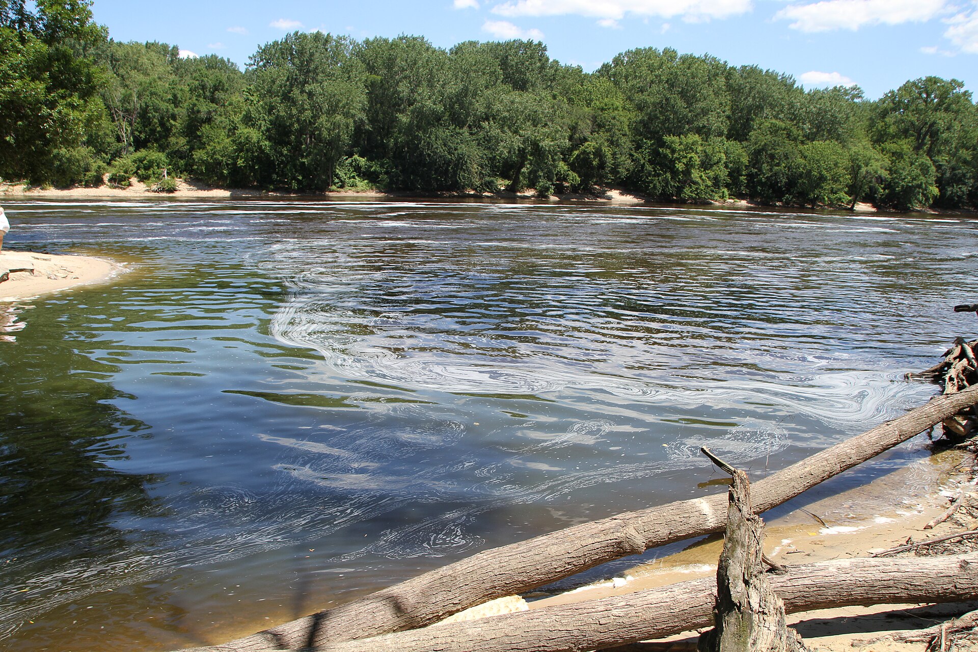
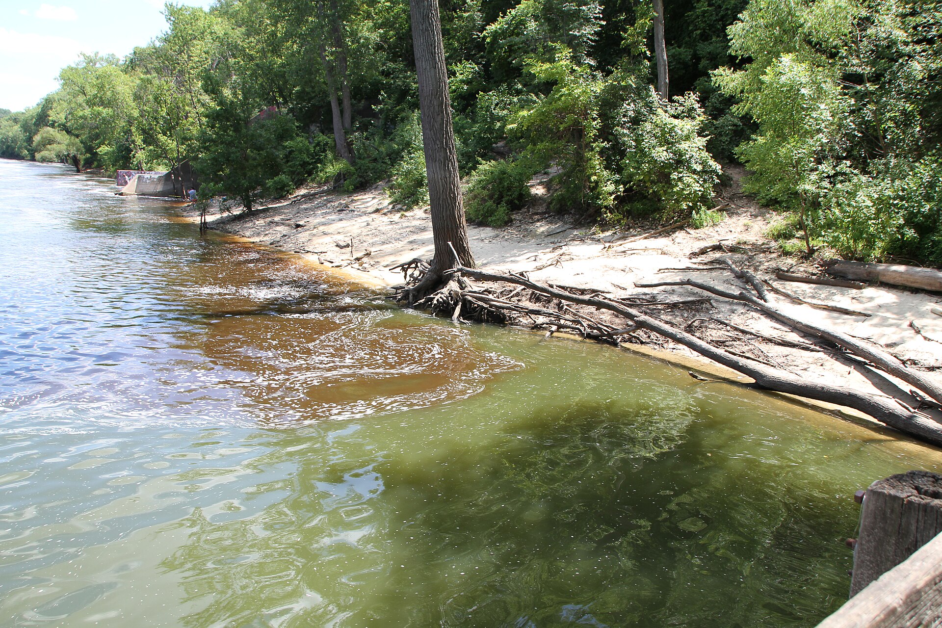
Minnehaha OLDP is not interchangeable with a fenced turf parcel somewhere else in the city. Its defining feature is the Mississippi River: wooded trails, floodplain terrain, shoreline, beach, seasonal change, and direct river-edge access.
That is why replacement cannot be measured only by acreage.
A replacement without comparable river access may add off-leash capacity. It does not replace Minnehaha.
This article seeks to makes a jurisdictional and federal public waterways point that: MPRB may regulate MPRB land. The National Park Service may regulate National Park Service land. Dogs must comply with applicable leash rules.3 Nothing on this page argues for trespass, unauthorized off-leash activity on federal land, or disregard of lawful resource-protection rules. However, if MPRB is eliminating a longstanding public river-access amenity that people can still technically access by other means, what exact problem is being solved? Moreover, what land is implicated (the beach? the river?), what authority is being used, and why is decommissioning necessary rather than boundary enforcement, fencing, signage, leash-transition zones, restricted areas, or targeted management?
MPRB has not answered that question.
Ordinary High Water Level and public-water boundaries matter
Minnesota water law uses Ordinary High Water Level as a key boundary concept for public waters. For watercourses, Minnesota DNR explains that OHWL is generally tied to the top of the channel bank.67
That does not decide this dispute. It shows why MPRB must distinguish between the river itself, public water, MPRB parkland, shoreline, beach, floodplain, former channel, accreted land, adjacent non-MPRB land, and the off-leash designation.
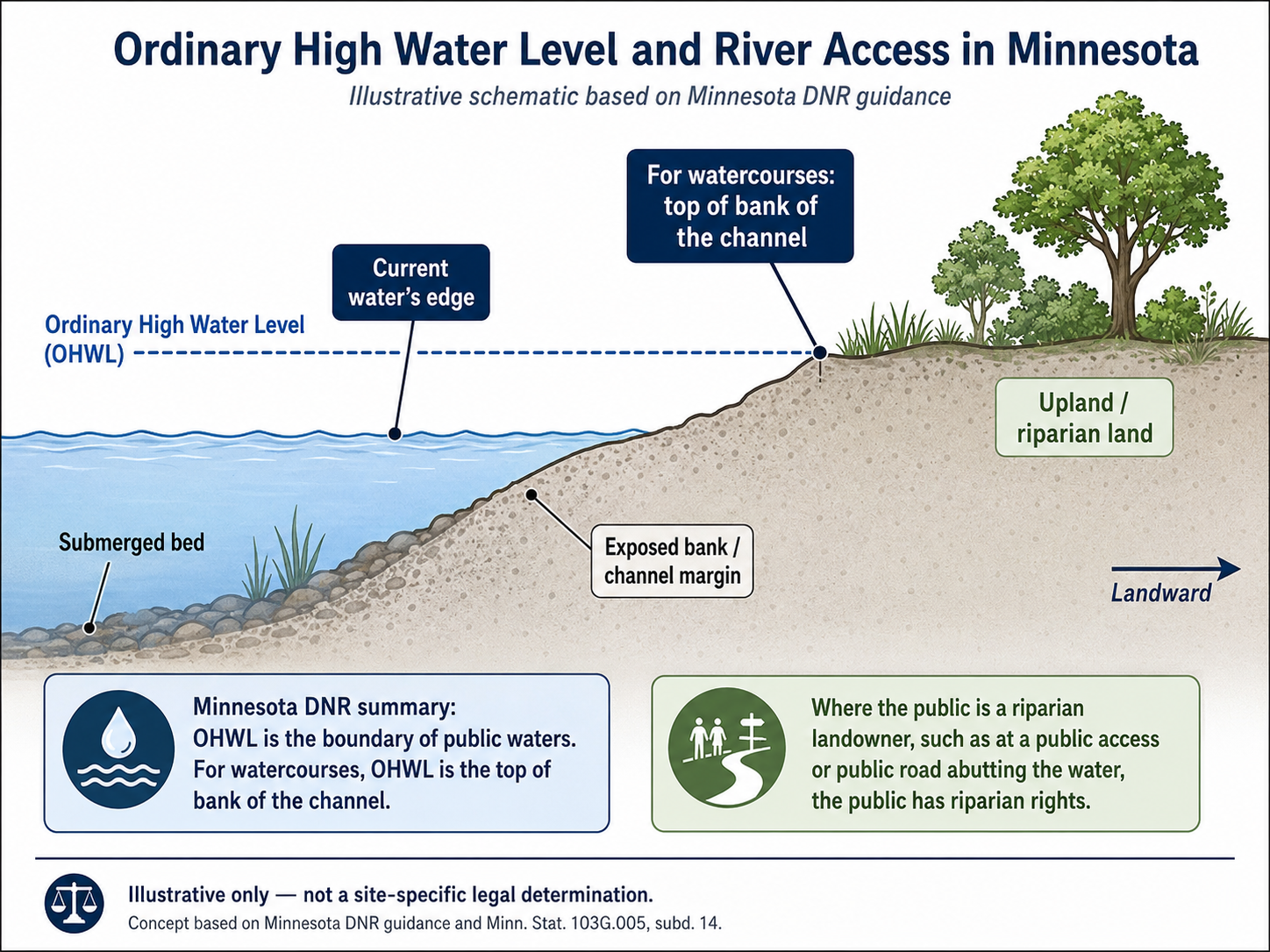
The Physical Record page addresses the related topographic issue: the riverbank, floodplain, channel margin, beach, and shoreline conditions have changed over time.
If the geography has changed, MPRB cannot treat the modern off-leash boundary as though it automatically maps onto a fixed historical, archaeological, burial-site, or sacred-use boundary.
Near the river is not the same as under the river.
A public-water analysis should identify what MPRB claims to control, what it does not control, where users may lawfully enter or remain, and what replacement is required if MPRB eliminates a longstanding practical route to the river.
The earlier fencing record pointed to management, not automatic closure
Before Resolution 2026-114, MPRB's public fencing process focused on dogs leaving the off-leash area, entering adjacent properties, and creating boundary, ecological, visitor-conflict, and enforcement concerns.45
The proposed remedy was fencing, signage, boundary demarcation, gates, and containment.
MPRB's own fencing FAQ stated that users and dogs would still be able to reach the river and part of the beach on Park Board property after fencing. The same project materials discussed chicane-style gates, floodplain and floodway issues, leash requirements beyond the dog-park boundary, and separating significant natural areas from dog use.4
That matters.
MPRB had already identified managed access as a possible remedy. If MPRB now claims full decommissioning is necessary, it should explain what changed.
The visitor footprint is not the legal boundary
The practical visitor-use corridor appears tied to the broader river corridor, not just the formal off-leash boundary. It includes river access, shoreline movement, adjacent land-management issues, and areas where NPS, MNHS, MPRB, and other authorities may have different roles.
This page does not defend off-leash use where leash rules apply.
It asks whether closure of the OLDP actually solves the problem MPRB claims to be addressing.
If the concern is activity on National Park Service land, MPRB should explain why enforcement, fencing, signage, and interagency coordination are insufficient.
If the concern is dogs near Mni Owe Sni generally, MPRB should explain why decommissioning the MPRB off-leash designation is the necessary and proportionate remedy.
If the concern is cultural or archaeological sensitivity in specific locations, MPRB should identify those locations in nonconfidential terms and explain why targeted protection is inadequate.
A remedy that does not match the actual visitor footprint is not evidence-based management.
Boundary, jurisdiction, and remedy must line up
The Mississippi River is not simply an extension of the MPRB dog park. It is a public water, a navigable river corridor, a floodplain, an ecological resource, and a jurisdictional boundary. MPRB should identify what conduct it seeks to regulate and where. Additionally, they should describe where the alleged harm occurs and why decommissioning is the selected remedy. This is essential given that the relevant boundaries of their jurisdiction may not be the same as:
- Broader Mni Owe Sni / Traditional Cultural Place landscape.
- Actual OLDP usage and federally protected river access sites.
- National Park Service land that they do not have regulatory authority over.
- Ordinary High Water Level-defined public waterways.
- Floodway and floodplain regions that are less likely to contain archaeological artifacts.
- Beach and shoreline that are less likely to contain archaeological artifacts.
If the problem is disturbance to burial sites or archaeological resources, MPRB should identify the protected area in nonconfidential terms and explain why buffers, restricted zones, monitoring, further survey, or boundary reduction are insufficient. The burial-site question is addressed more fully on the Burial Sites page.
If the problem is broader Traditional Cultural Place incompatibility or ceremonial concern, MPRB should say so directly and release the nonconfidential findings supporting that conclusion. If the rationale depends on spiritual, ceremonial, or religious incompatibility with dogs rather than a disclosed secular resource-management basis, that issue is addressed more fully on the First Amendment Concerns page.
The remedy must match the land, the jurisdiction, and the actual harm.
Replacement must be equivalent, not symbolic
Minnehaha offers more than off-leash acreage.
It offers river access, wooded trails, floodplain terrain, shoreline, beach, natural surface, seasonal variation, long-distance circulation, regional destination value, and a public connection to the Mississippi River.
A small fenced parcel elsewhere in the city may be useful. It may even add needed capacity. But unless it provides comparable river access, wooded terrain, natural-surface circulation, parking or transit access, and regional functionality, it is not equivalent replacement.
That matters for permit holders.
MPRB sells off-leash permits for a system that includes Minnehaha. MPRB's own dog-park materials state that an off-leash permit is required and that permits are valid across the dog-park system.12
If MPRB removes a major and unique amenity from that system, it should publish a permit-holder impact analysis before closure. That analysis should address lost amenity value, crowding at remaining sites, substitute access, travel burden, pro rata refunds, credits, fee adjustments, and the cost and timing of equivalent replacement.
A future promise to look for another site does not replace present access.
Minimum public record before eliminating off-leash river access
Before decommissioning Minnehaha OLDP, MPRB should disclose the following in public, nonconfidential terms:
Minimum public record
- Boundary map: Current OLDP boundary, proposed post-decommissioning boundary, MPRB-managed land, NPS land, adjacent land, ordinary-high-water boundary, floodway, floodplain, river access points, beach, shoreline areas, public trails, and leash-transition areas.
- Actual problem: Whether the concern is off-leash spillover, burial-site protection, archaeological sensitivity, Traditional Cultural Place incompatibility, ecological damage, visitor conflict, adjacent-property conflict, public safety, or some combination.
- Location of concern: Where visitor activity actually occurs, what portion is inside the OLDP, what portion is outside it, and what conflicts, enforcement actions, ecological impacts, or resource concerns have been documented by location.
- Alternatives considered: Whether MPRB evaluated fencing, boundary demarcation, gates, leash-transition zones, restricted zones, riverbank buffers, seasonal limits, ceremonial-use limits, restoration areas, additional survey, monitoring, NPS enforcement, interagency patrols, partial closure, or targeted closure of specific areas.
- Reason alternatives were rejected: Why those narrower remedies are inadequate if the real problem is specific land, specific conduct, specific resources, or specific jurisdiction.
- Replacement equivalence: Whether replacement will include river access, wooded trails, beach or water access, equivalent acreage, equivalent terrain, comparable travel burden, comparable parking or transit access, and comparable system capacity before closure.
- Permit-holder remedy: Whether MPRB will offer refunds, credits, fee adjustments, substitute access, or other remedies for permit holders who paid for access to a system that included Minnehaha.
- Cost and funding: Costs already spent on studies, fencing, staff time, legal review, consultation, decommissioning planning, and replacement planning; projected decommissioning and replacement costs; and the funding source for equivalent replacement.
These are not hostile questions. They are the minimum questions required for public accountability.
Bottom line
Minnehaha is called the river dog park for a reason.
Its value is inseparable from the Mississippi River, the wooded riverbank, the floodplain, the beach, and the ability of dogs and people to move through a natural river corridor.
That does not mean the area should be unmanaged. It means management must be specific.
Boundary spillover calls for boundary enforcement. NPS leash compliance calls for leash enforcement. Archaeological potential calls for survey and protection. Ecological damage calls for disclosed data and mitigation. Confirmed or suspected burial-site concerns call for the proper legal process. Broader Traditional Cultural Place concerns call for a public decision record that explains the nonconfidential basis and alternatives considered.
MPRB has not shown that eliminating off-leash river access is necessary, that equivalent replacement will exist before access is lost, that narrower remedies are insufficient, or that the chosen remedy matches the actual problem.
Until it does, decommissioning Minnehaha OLDP remains premature, inadequately justified, and inconsistent with public accountability.
Related pages
Sources
- MPRB, Minnehaha Off-Leash Dog Park
- MPRB, Dog Parks, including off-leash permit requirement and systemwide permit validity
- National Park Service, Pets - Mississippi National River & Recreation Area
- MPRB, Minnehaha Dog Park Perimeter Fencing
- MPRB Resolution 2026-114
- Minnesota DNR, Ordinary High Water Level
- Minn. Stat. § 103G.005, subd. 14, Ordinary High Water Level
- Wikimedia Commons, Bjoertvedt, "Hennepin county MN IMG 1693 minnehaha minneapolis.JPG," CC BY-SA 3.0
- Wikimedia Commons, Bjoertvedt, "Hennepin county MN IMG 1724 minnehaha and mississippi river minneapolis.JPG," CC BY-SA 3.0
- Wikimedia Commons, National Park Service, "The Ford Parkway Bridge.JPG," public domain